Lord of the Rings Map
The map behind The Lord of the Rings, read in six stages from the Shire to the slopes of Mount Doom.
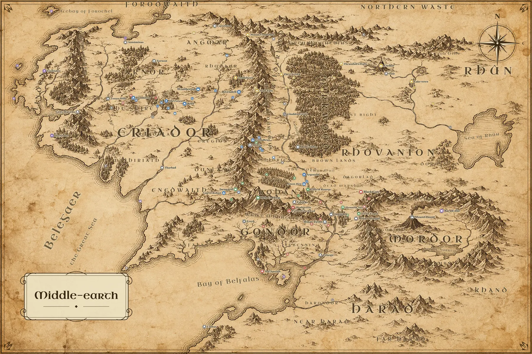
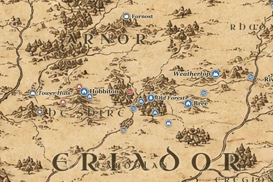
The Shire and Eriador
The story starts in the northwest. The Shire is a small pocket of farmland west of the Brandywine, with Hobbiton at its center and Michel Delving as its chief town. East of it lie the Old Forest, the house of Tom Bombadil, the Barrow-downs and then Bree, about 120 miles from Hobbiton. Everything around is empty country, the remains of Arnor: the ruins of Fornost and Annúminas to the north, Cardolan and Minhiriath to the south, and the old tower of Amon Sûl on Weathertop, about 100 miles east of Bree, where the Nazgûl attack Frodo.
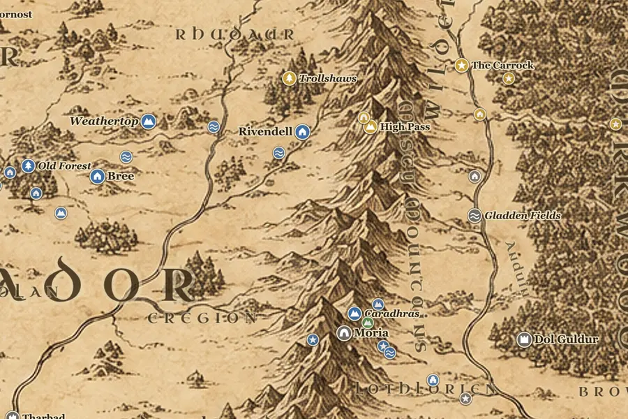
Rivendell to Moria
Past Weathertop the Great East Road crosses the Last Bridge and the Ford of Bruinen and ends at Rivendell, about 460 miles by road from Hobbiton. The Fellowship leaves there in December TA 3018 and turns south along the western feet of the Misty Mountains, through the holly country of Eregion where the Rings of Power were made. Snow turns them back from the pass of Caradhras, so they take the Doors of Durin instead and cross under the mountains through Moria, the dwarf city of Khazad-dûm, where Gandalf falls at the Bridge of Khazad-dûm.
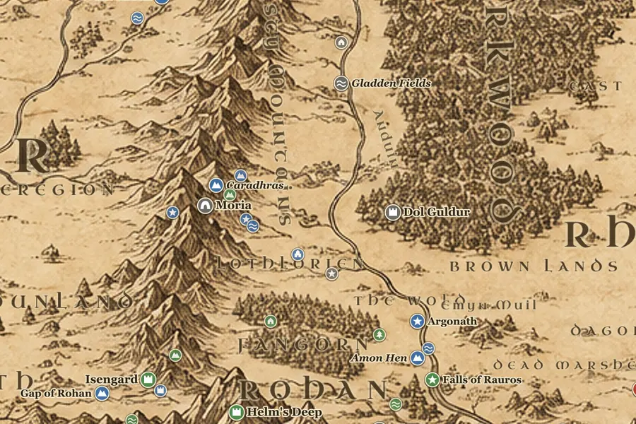
Lothlórien and the Anduin
The eastern gate of Moria opens on the Dimrill Dale, with the dark water of Mirrormere below. From there the Fellowship walks down to Lothlórien, the woods between the Silverlode and the Anduin, and stays in Caras Galadhon with Celeborn and Galadriel. They leave by boat and follow the Great River south past the Brown Lands, through the pillars of the Argonath and across the lake of Nen Hithoel. At Amon Hen above the falls of Rauros the company breaks: Boromir dies, Merry and Pippin are taken, and Frodo and Sam cross to the east bank.
Rohan and Isengard
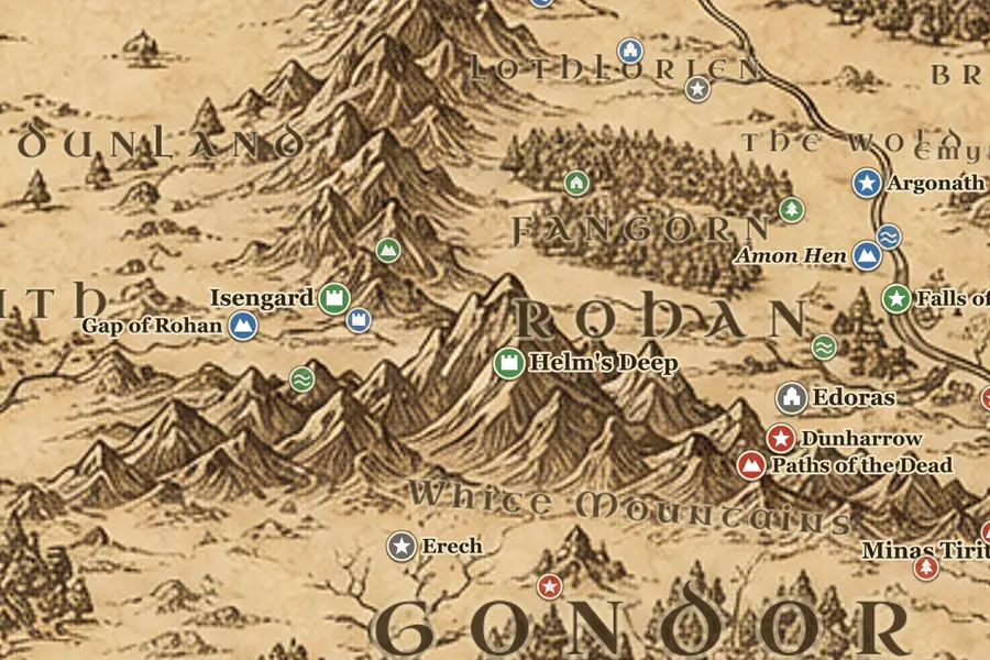
Rohan fills the grassland between the Misty Mountains and the White Mountains, watered by the Entwash. Aragorn, Legolas and Gimli run west across it after the orcs, roughly 130 miles in under four days, to the eaves of Fangorn Forest. Merry and Pippin escape into Fangorn and meet Treebeard. South of the forest, in the valley of Nan Curunír, stands Isengard with the tower of Orthanc, which the Ents flood. Edoras and the golden hall of Meduseld lie on a hill to the southeast, with Helm's Deep about 60 miles west of it under the mountains.
Gondor
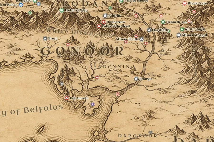
Gondor lies south of the White Mountains, in a broad arc from Anfalas in the west to Ithilien across the Anduin. Minas Tirith stands against the shoulder of Mount Mindolluin, with the Pelennor Fields in front of it and ruined Osgiliath on the river beyond. Southwest along the coast are Dol Amroth and the harbor of Pelargir, where Aragorn takes the ships after the Paths of the Dead. Edoras to Minas Tirith is roughly 380 miles, which is why the ride of the Rohirrim takes six days in March TA 3019.
Mordor
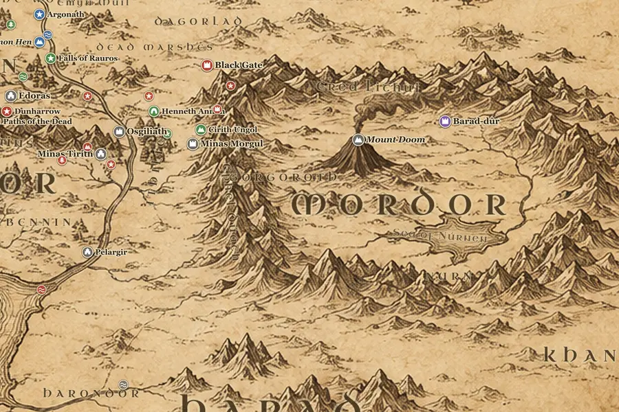
Mordor sits east of the Anduin behind three mountain walls. Frodo and Sam approach from the north over the Emyn Muil and the Dead Marshes, find the Black Gate shut, and turn south through Ithilien with Gollum. They climb the pass of Cirith Ungol above Minas Morgul, cross the plain of Gorgoroth with Barad-dûr in view, and reach Mount Doom on 25 March TA 3019. From Hobbiton their route measures about 1,800 miles and took 183 days, an approximate figure based on Fonstad's Atlas.
Frequently asked questions
What is the map in The Lord of the Rings called?
There is no single name for it. The books print a general map of the northwest of Middle-earth in the Third Age, plus a closer map of the Shire and a battle map of Rohan, Gondor and Mordor. The general map covers about 1,300 miles east to west. This site draws one continuous map that includes all three areas.
How long is the journey in The Lord of the Rings?
Frodo's road from Bag End to Mount Doom runs about 1,800 miles and takes 183 days, from 23 September TA 3018 to 25 March TA 3019. The Fellowship itself only holds together for 62 days, from Rivendell in December to the breaking at Amon Hen on 26 February. Mileages are approximate.
Where does the Fellowship break up on the map?
At Amon Hen, the western hill above the falls of Rauros at the southern end of Nen Hithoel, roughly 100 miles north of the Black Gate. Frodo and Sam cross to the eastern shore and head for Mordor, Merry and Pippin are carried west toward Isengard, and Aragorn, Legolas and Gimli follow them into Rohan.