Regions of Middle-earth
Thirteen regions, from Lindon and the Shire in the west to Rhûn and Harad in the east and south.
10 places
The Shire
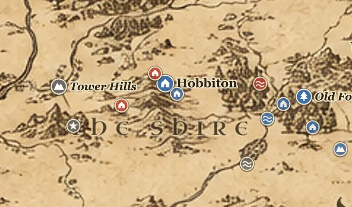
The Shire lies in the northwest of Eriador, west of the Brandywine River and east of the Far Downs, with the Blue Mountains beyond its western horizon and the Great East Road crossing it toward Bree. Hobbits farm its four Farthings and, later, the Westmarch. No king rules here after Arthedain falls, and only the Rangers watch its borders.
10 places
Lindon
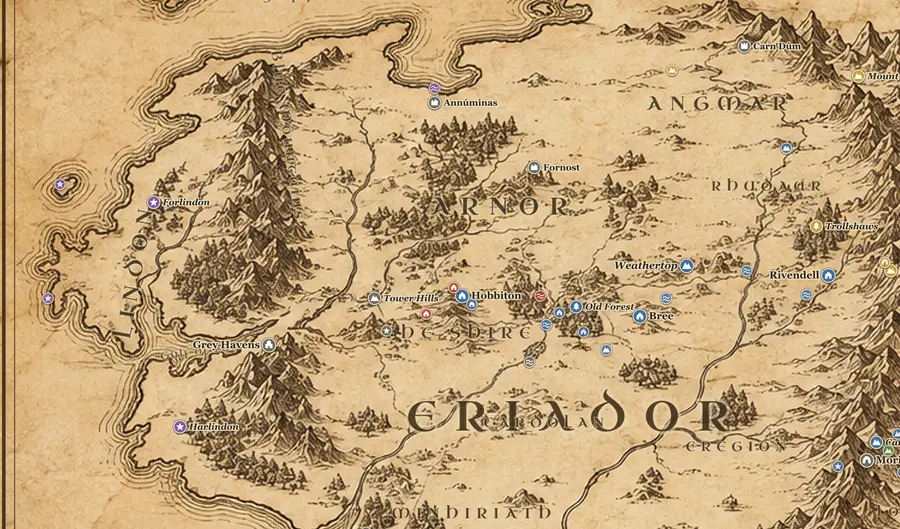
Lindon is the narrow coastal country between the Blue Mountains and the Great Sea, split by the Gulf of Lune into Forlindon in the north and Harlindon in the south. The Grey Havens stand at the head of the gulf, where the River Lune reaches the sea. Cirdan the Shipwright rules here, and Gil-galad ruled before him in the Second Age.
24 places
Eriador
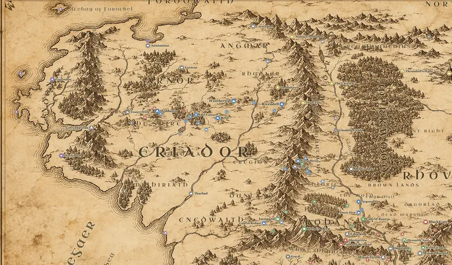
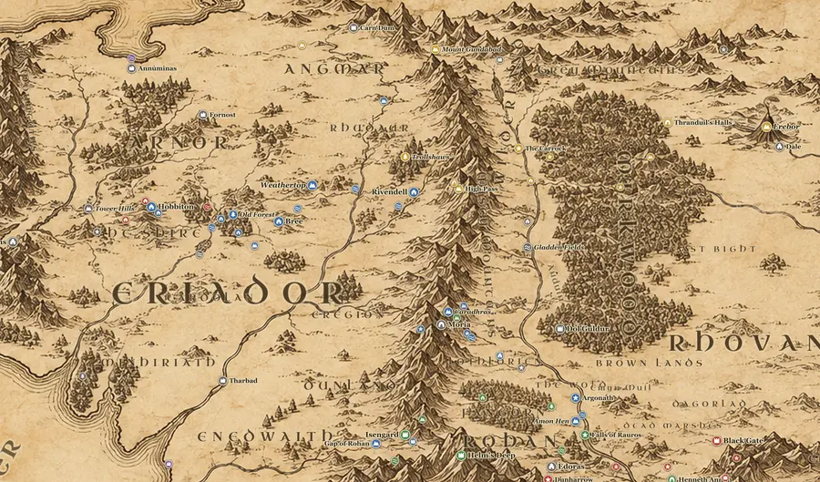
Eriador is the great land between the Blue Mountains in the west and the Misty Mountains in the east, bounded by the Ice Bay of Forochel to the north and the Greyflood to the south. The Great East Road crosses it from the Grey Havens to Rivendell. Once it held the North-kingdom of Arnor, but by TA 3018 it is mostly empty, with Bree the only town of Men.
6 places
Angmar
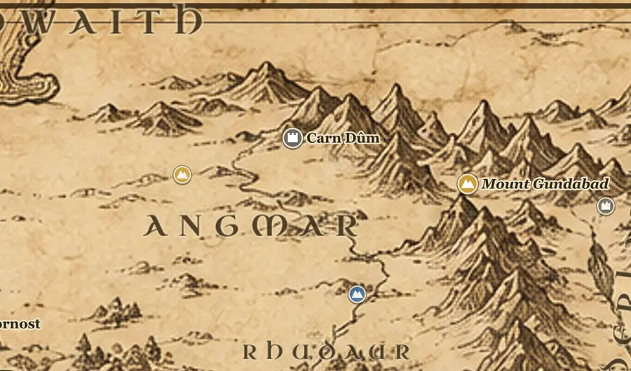
Angmar lies at the far north of the Misty Mountains, straddling the range where it meets the Mountains of Angmar, north of the Ettenmoors and Rhudaur. Its fortress is Carn Dum in the western mountains, and Mount Gundabad stands at the junction of the ranges to the southeast. Beyond it lies the Forodwaith, the frozen Northern Waste. It was founded and ruled by the Lord of the Nazgul.
11 places
Misty Mountains
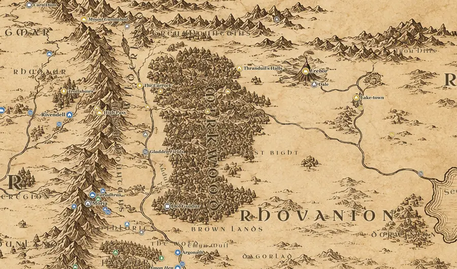
The Misty Mountains, Hithaeglir, run roughly 900 miles from Mount Gundabad in the north down to Methedras above the Gap of Rohan. They divide Eriador in the west from Rhovanion and the Anduin valley in the east. Only a few crossings exist: the High Pass above Rivendell, the Redhorn Pass under Caradhras, and the dark road through Moria beneath the mountains.
10 places
Rhovanion
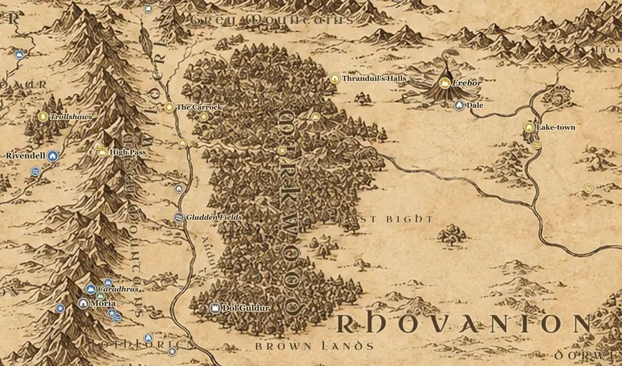
Rhovanion is the vast country between the Misty Mountains and the Sea of Rhun, with Mirkwood at its heart and the Great River Anduin running the length of its western side. The Anduin vales hold Beorn's Hall and the Carrock, the Gladden Fields lie downstream, and the golden wood of Lothlorien stands on the eastern bank below the Dimrill Dale. Men of the vales, Elves and Beornings live here.
7 places
Mirkwood
Mirkwood covers the middle of Rhovanion, a forest roughly 400 miles north to south lying east of the Anduin and west of the Long Lake and the River Running. The Mountains of Mirkwood rise in its center, Dol Guldur sits on a hill in its southwest, and Thranduil's Halls lie under the trees in the northeast. Wood-elves, spiders and Orcs share it.
9 places
Dale and Erebor
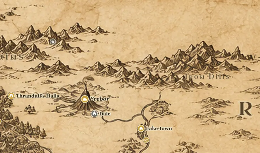
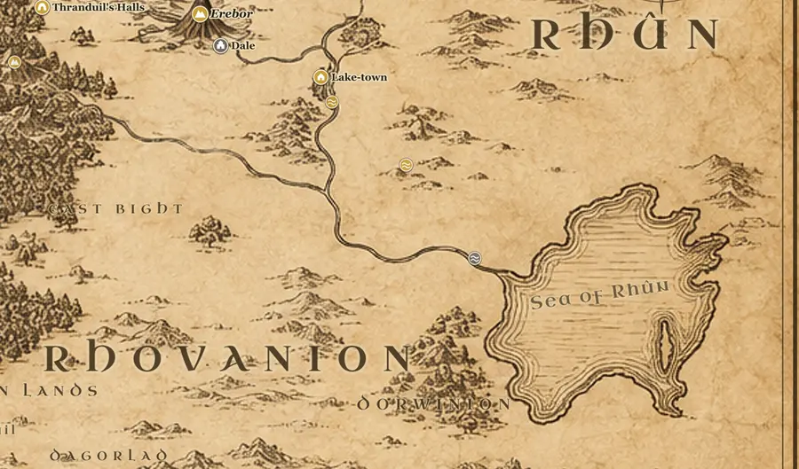
Dale and Erebor lie in the northeast of the map, where the River Running flows out from under the Lonely Mountain toward the Long Lake. The Grey Mountains and the Withered Heath are to the northwest, the Iron Hills to the east, and Mirkwood to the southwest. Dwarves of Durin's folk hold Erebor, Men of Dale hold the city, and Lake-town sits on the water below.
3 places
Rhûn
Rhun is the east of the Middle-earth map, beyond Mirkwood and the River Running. Its one clear landmark is the inland Sea of Rhun, fed from the north and lying south of the wine-country of Dorwinion. Beyond the sea the map runs out of names. Easterlings live here, and for most of recorded history their armies came west against Gondor and the Northmen.
15 places
Rohan
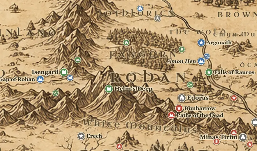
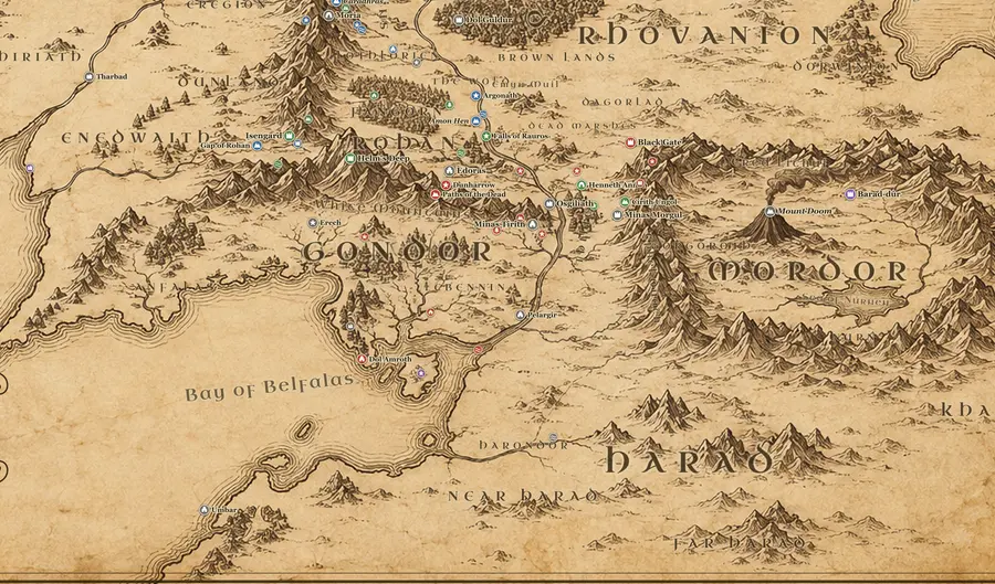
Rohan fills the plains between the Misty Mountains and Fangorn in the north, the White Mountains in the south, the River Isen in the west and the Anduin in the east. Edoras stands on a hill at the feet of the mountains, Helm's Deep guards the western vales, and Isengard sits in the Gap of Rohan. The Rohirrim, horse-breeding Men of the north, have held it since TA 2510.
29 places
Gondor
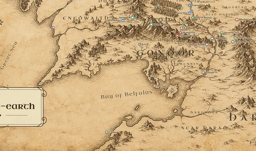
Gondor lies south of Rohan and west of Mordor, spread around the White Mountains and along the lower Anduin to the sea. Minas Tirith stands against Mount Mindolluin on the western bank, with Osgiliath and Ithilien across the river facing Mordor. Its coastal fiefs run west through Lebennin and Belfalas to Dol Amroth and Anfalas. Men of Numenorean descent rule it, under Stewards since TA 2050.
15 places
Mordor
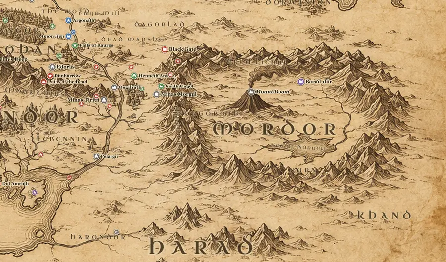
Mordor sits in the southeast of the map, a rough rectangle fenced by the Ephel Duath on the west and south and the Ered Lithui on the north. The Black Gate closes its northwest corner above the plain of Dagorlad and the Dead Marshes. Inside are the ash plateau of Gorgoroth, Mount Doom, the tower of Barad-dur, and the farmlands of Nurn around the bitter Sea of Nurnen.
7 places
Harad
Harad is everything south of Gondor and Mordor on the Middle-earth map. South Gondor, the debated land of Harondor, lies between the River Poros and the haven of Umbar, and beyond that stretch Near Harad and then Far Harad, which runs off the edge of most maps. Khand sits southeast of Mordor. The Haradrim, the Southrons, fought for Sauron with cavalry and with the great beasts called mumakil.