Silmarillion Map: Beleriand and the First Age
Beleriand lay west of the Blue Mountains and sank at the end of the First Age. Here is what still shows on a Third Age map.
Why Beleriand is not on this map
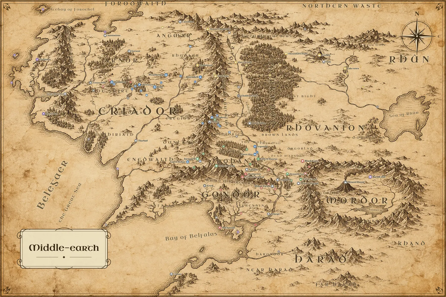
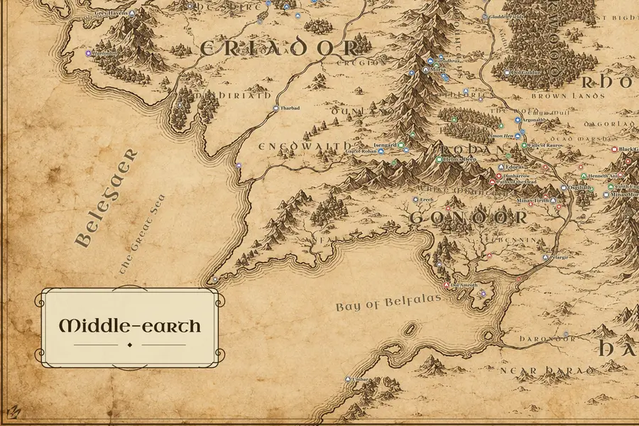
The Silmarillion is set in Beleriand, a country that lay west of the Blue Mountains, beyond the left edge of the usual map of Middle-earth. Doriath, Nargothrond, Gondolin, Hithlum and Angband all stood there. At the end of the First Age the War of Wrath broke the land, and the sea covered nearly all of it. So a Third Age map does not omit Beleriand by choice: the coastline you see is the new shore left after it sank, and the Blue Mountains are the old eastern border of the drowned country.
What survives above water
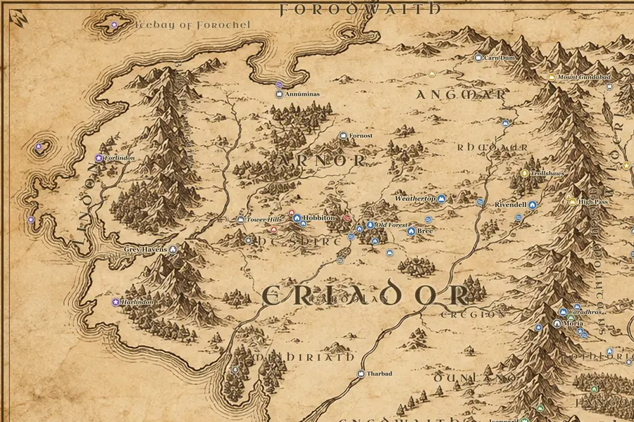
Three islands on this map are the tops of First Age hills. Himling, off the northwest coast, was Himring, the fortified hill of Maedhros son of Fëanor. Tol Fuin was the highland of Dorthonion, where Beren and his father Barahir held out against Morgoth. Tol Morwen, further south, held the standing stone raised for Túrin and Morwen beside the river Teiglin. The Ered Luin, the Blue Mountains north of the Gulf of Lune, are the same range that held the dwarf cities of Nogrod and Belegost, now broken and reduced.
Lindon and the Elven west
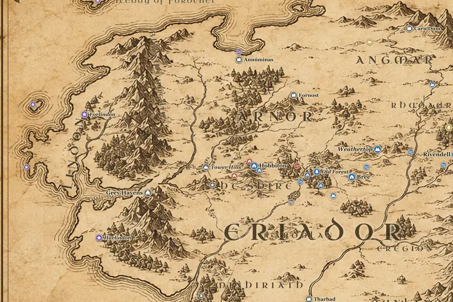
Lindon is the strip of coast between the Blue Mountains and the sea, and it is the last piece of Beleriand still above water: Forlindon north of the Gulf of Lune and Harlindon south of it. Gil-galad ruled there through the Second Age, and the Grey Havens at Mithlond were built as the harbor for ships leaving into the West. The Tower Hills east of the havens held the three elf-towers and one of the palantíri. Further east, Eregion beside the Misty Mountains was the Second Age realm where Celebrimbor made the Rings of Power.
The Númenórean havens
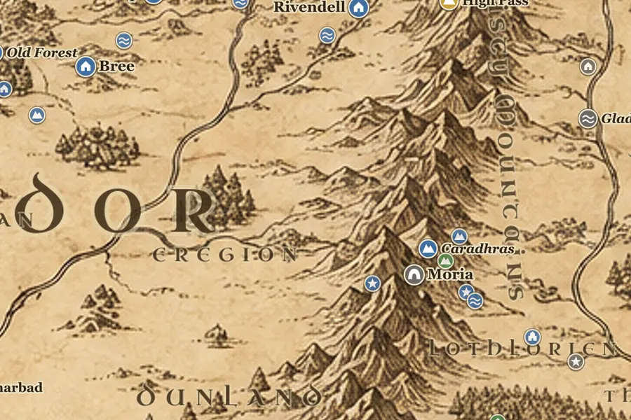
Much of what looks like ruin on the map is Second Age work by men of Númenor. Lond Daer stood at the mouth of the Gwathló in Enedwaith, first built as a shipyard and timber port, and the forests of Minhiriath were cut down to supply it. Further south, Pelargir on the Anduin became the chief haven of the Faithful, and Umbar on its southern cape became the stronghold of the King's Men and later of the Corsairs. Osgiliath, Minas Anor and Minas Ithil were all founded after Númenor drowned in SA 3319.
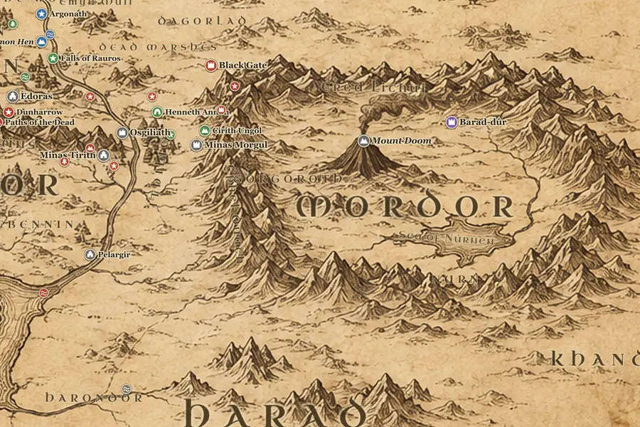
Mordor in the Second Age
Sauron chose Mordor about SA 1000 and built Barad-dûr near Mount Doom, using the mountain's fire in the making of the One Ring. The Last Alliance of Elves and Men marched east across Dagorlad and besieged the tower for seven years, and Sauron fell in SA 3441. The map shows this ground as it stood in the Third Age, so the Black Gate and the towers of the Teeth are later Gondorian work on an older battlefield. Cuiviénen, where the Elves first woke, lay far east of the map's edge and was never drawn by Tolkien.
Frequently asked questions
Is there a map of Beleriand in The Silmarillion?
Yes. Published editions of The Silmarillion carry their own map of Beleriand, which is a separate area west of the Blue Mountains. It does not overlap the Lord of the Rings map except at the Ered Luin. This site maps the Third Age, and marks the pieces of Beleriand that survived the drowning.
What happened to Beleriand?
The Valar sent a host from the West against Morgoth in the War of Wrath at the end of the First Age. The fighting broke the land and the sea came in over almost all of it. Only Lindon, the islands of Himling, Tol Fuin and Tol Morwen, and the western slopes of the Blue Mountains remained above water.
Where was Gondolin on a map of Middle-earth?
Gondolin stood in a ring of mountains called the Echoriath, in the north of Beleriand, west and north of the Blue Mountains. That whole area is now under the sea, off the western edge of this map. Nothing of it is visible on a Third Age map.