Plain · Mordor
Plateau of Gorgoroth
The ash plain of northwestern Mordor, holding Mount Doom and the Dark Tower
- Appears in
- The Lord of the Rings
- Region
- Mordor
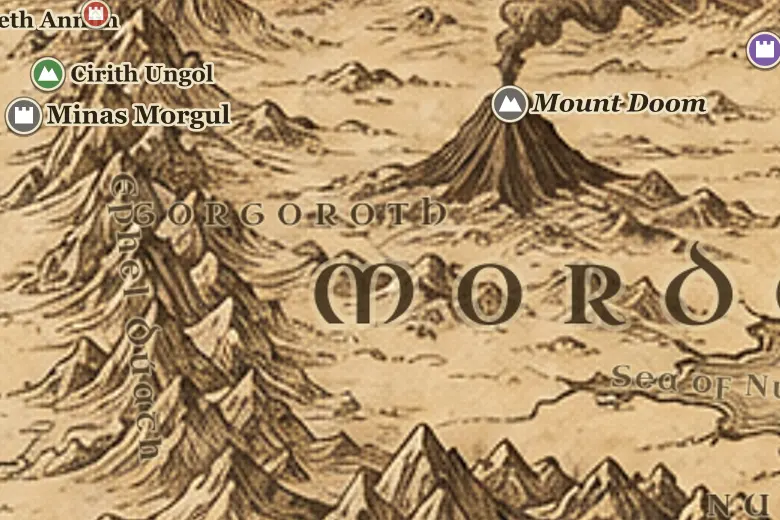
The plateau fills the angle where Mordor's two mountain walls meet. Roads cross it from the Isenmouthe in the north, from Cirith Ungol in the west, and from Barad-dûr west to Mount Doom. Nothing grows there but thorny scrub and gray lichen, and the air carries fumes from the mountain.
Gorgoroth held the forges, pits and armories of Mordor, while the food came from the slave-worked fields around the Sea of Núrnen in the south. The Last Alliance fought its way across this plain in SA 3434 and camped on it through the seven year siege of the Dark Tower.
Frodo and Sam crossed Gorgoroth in the last week of March TA 3019, hiding in hollows by day, until the armies drawn to the Black Gate left the plain empty enough to reach the mountain.
Events at this place
-
SA 3434 · The Silmarillion
The Last Alliance crosses the plain
The armies of Gil-galad and Elendil defeated Sauron's host on Gorgoroth and laid siege to Barad-dûr.
-
TA 3019, March 22 · The Lord of the Rings
The last march to Mount Doom
Frodo and Sam struggled east across the ash plain in late March while Sauron's forces moved north to the Black Gate.
Frequently asked questions
Where is Gorgoroth on the Middle-earth map?
In northwestern Mordor, the plateau enclosed by the Ephel Dúath to the west and the Ered Lithui to the north, with Mount Doom at its center.
What was on the plateau of Gorgoroth?
Mount Doom, Barad-dûr, and the mines, forges and armories of Mordor. Its food came from the fields of Nurn to the south.