Mountain · Misty Mountains
Methedras
The Last Peak, where the Misty Mountains end above Isengard and Fangorn
- Appears in
- The Lord of the Rings
- Region
- Misty Mountains
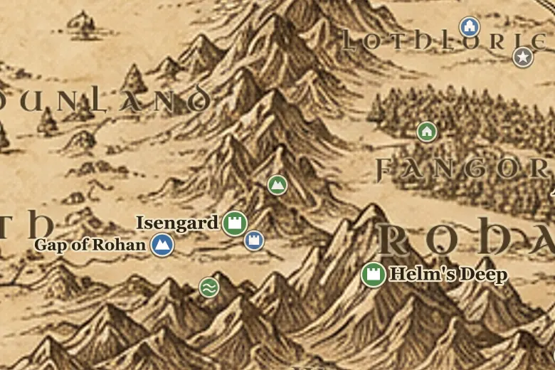
Methedras closes the Misty Mountains at their southern end, some nine hundred miles from Mount Gundabad. Below it on the west lies the valley of Nan Curunír with Isengard in it, and south of that the Gap of Rohan opens the road between Eriador and the south. East of the peak the land falls into Fangorn Forest.
Water off the mountain feeds both sides of the story. The Isen rises on its western flank and runs down past Isengard to the Fords. Streams off the eastern spurs gather into the Entwash, which crosses Rohan to the Anduin.
Treebeard's ent-house, Wellinghall, sits on the first shelf of Methedras under a spring that falls from the heights, and Merry and Pippin were carried there on 29 February TA 3019. From the slopes nearby the Ents looked down on Saruman's works, which is part of why Fangorn's anger turned on Isengard.
Events at this place
-
TA 3019, February 29 · The Lord of the Rings
Merry and Pippin at Wellinghall
Treebeard carried the hobbits to his house on the lower slopes of Methedras before the Entmoot that decided to attack Isengard.
Frequently asked questions
Where is Methedras?
At the southern end of the Misty Mountains, directly north of Isengard and the Gap of Rohan, with Fangorn Forest on its eastern side.
What does Methedras mean?
Last Peak in Sindarin, marking the final mountain of the Misty Mountains range.