Mountain · Gondor
Mount Mindolluin
The last peak of the White Mountains, with Minas Tirith built on its eastern shoulder
- Appears in
- The Lord of the Rings
- Region
- Gondor
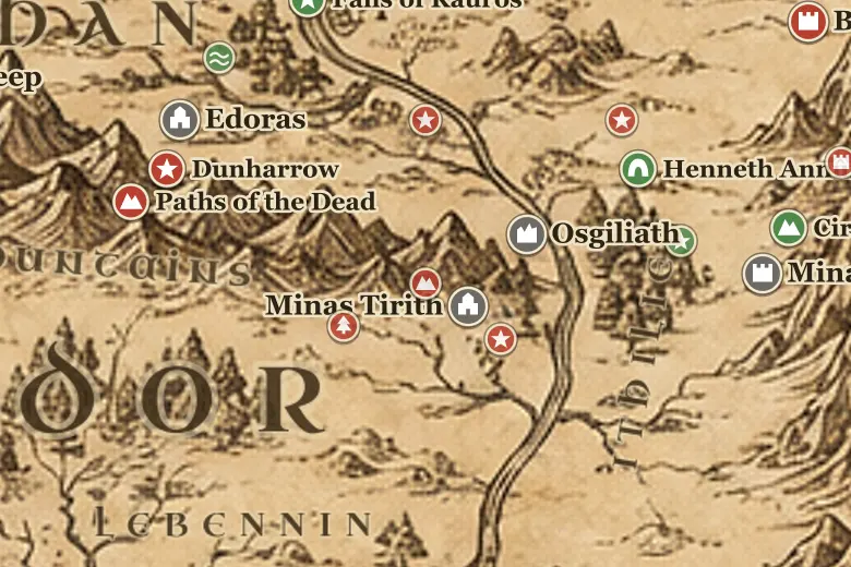
Mindolluin closes the White Mountains at their eastern end, west of Minas Tirith and south of the Drúadan Forest. The city is not on the mountain itself but on a rock shelf thrust out from it, which is why the seven levels are backed by cliff rather than by open ground, and why no army could surround Minas Tirith completely.
A hidden path climbs from the rear of the Citadel to Rath Dínen, the Silent Street, where the tombs of the Kings and the Stewards stand. Denethor burned himself there in the House of the Stewards during the siege.
In June TA 3019 Gandalf led Aragorn up the mountain above the tree line. In a hollow of snow they found a young White Tree, a seedling of Nimloth's line, and it was planted in the Court of the Fountain in place of the dead tree.
Events at this place
-
TA 3019, March 15 · The Lord of the Rings
Denethor's pyre
During the siege the Steward burned himself in the House of the Stewards in Rath Dínen, on the shoulder of the mountain.
-
TA 3019, June 25 · The Lord of the Rings
The sapling of the White Tree
Gandalf and Aragorn climbed Mindolluin and found a young White Tree growing in the snow, which was planted in the Citadel.
Frequently asked questions
Where is Mount Mindolluin on the Middle-earth map?
At the eastern end of the White Mountains in Gondor, directly west of Minas Tirith, which is built on a spur of it.
What is on Mount Mindolluin?
Rath Dínen, the burial street of the Kings and Stewards, lies on its shoulder, and the sapling of the White Tree was found on its upper slopes.