Island · Gondor
Cair Andros
A long ship-shaped island splitting the Anduin north of Osgiliath
- Appears in
- The Lord of the Rings
- Region
- Gondor
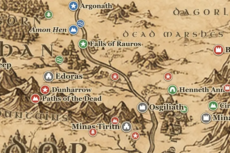
Cair Andros sits in the Anduin upstream from Osgiliath and downstream from the Entwash mouth, roughly level with the Field of Cormallen on the eastern bank. The name means Ship of Long-foam, because the island is long and narrow and its northern end cuts the current into white water like a prow.
Gondor held it as a fort. Whoever holds Cair Andros controls whether armies can cross the Anduin north of Osgiliath and come down on the Pelennor from behind, so the garrison there mattered as much as the bridge-town below.
In March TA 3019 Sauron's forces took the island and killed or drove off the defenders, freeing a crossing for the army that later moved against Minas Tirith. Faramir had stationed men there before the retreat from Osgiliath.
After the Pelennor was won, Aragorn's host marched north past the island on its way to the Black Gate, and a detachment was left to hold it again.
Events at this place
-
TA 3019, March 10 · The Lord of the Rings
Cair Andros falls
Sauron's forces stormed the island garrison before the Battle of the Pelennor Fields, opening a northern crossing of the Anduin.
Frequently asked questions
What does Cair Andros mean?
Ship of Long-foam, from the island's shape and the white water thrown up at its northern point.
Where is Cair Andros on the map?
In the Anduin north of Osgiliath, between the Gondor shore and northern Ithilien, near the Field of Cormallen.