Region · Eriador
Minhiriath
The empty land between the Brandywine and the Greyflood, south of the Shire
- Appears in
- Appendices
- Region
- Eriador
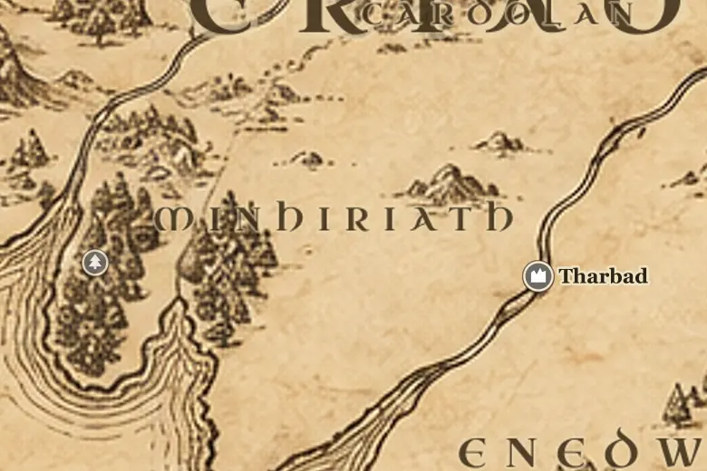
The name means Between the Rivers, and that is exactly what it is: the land enclosed by the Baranduin on the north and west and the Gwathló on the south. The Shire sits above its northern boundary, Tharbad guards its southeastern corner, and the North-South Road runs down its eastern side toward Gondor.
Minhiriath was once forest. Second Age felling for ships and settlement opened it up, and in the days of Arnor it was part of the kingdom of Cardolan, with farms and a road network. The wars with Angmar in the fifteenth century of the Third Age wrecked the region's defences, and the Great Plague of TA 1636 finished the population.
After that the land simply stayed empty. Travellers on the Greenway crossed it without meeting anyone, wild folk kept to the coastal woods, and the maps of the War of the Ring show a large green space with two rivers and a single road. The Fellowship never enters it, and that emptiness is the whole of its Third Age history.
Events at this place
-
TA 861 · Appendices
Part of the kingdom of Cardolan
When Arnor was divided, Minhiriath fell within Cardolan and was settled and worked from Tharbad and the coast.
-
TA 1636 · Appendices
The Great Plague empties the land
The plague spread north through Eriador and killed most of the inhabitants. Minhiriath was never resettled in the Third Age.
Frequently asked questions
Where is Minhiriath on the Middle-earth map?
South of the Shire, between the river Brandywine and the river Greyflood, with the coast on its west and Tharbad at its southeastern edge.
Why is Minhiriath empty?
Its forests were cut in the Second Age, the wars with Angmar broke Cardolan, and the Great Plague of TA 1636 killed nearly all who were left.