Region · Mordor
Nurn
The southern province of Mordor, the only part of the Black Land that could grow food
- Appears in
- The Lord of the Rings
- Region
- Mordor
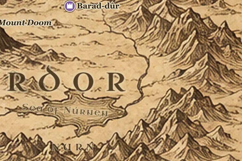
Look at the lower right of Mordor on the map: the country around the inland sea is Nurn. The mountain walls are further apart here than in the north, and streams run down from them into the Sea of Núrnen, so the region has soil and water where Gorgoroth has neither.
This is the part of Mordor that made the rest possible. Grain and other supplies traveled north from Nurn to the garrisons at the Black Gate and the forges of Gorgoroth. The laborers were thralls brought in from Khand, Rhûn and Harad, and they were never permitted to leave.
After the fall of Barad-dûr, King Elessar gave Nurn to the freed slaves as their own land, and it became a country of free men in the Fourth Age.
Events at this place
-
TA 3019, May 2 · The Lord of the Rings
Nurn granted to the freed slaves
After Sauron's fall King Elessar freed the thralls of Mordor and gave them all the land of Nurn around the inland sea.
Frequently asked questions
Where is Nurn on the Middle-earth map?
In the southern and southeastern part of Mordor, surrounding the Sea of Núrnen, south of the Gorgoroth plateau.
Why did Sauron need Nurn?
It was the only fertile part of Mordor. Its fields fed the armies that Gorgoroth could not supply, since nothing grows on the ash plain.