Region · Harad
Harondor
South Gondor
South Gondor, the wasted borderland between the Poros and the Harnen
- Appears in
- Appendices
- Region
- Harad
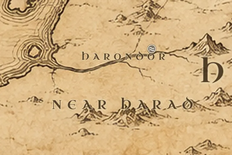
On the map Harondor fills the space between Gondor proper and Harad, with the Ephel Dúath and Mordor to its northeast and the sea to its west. The name simply means South Gondor.
The kings of Gondor once ruled it outright and pushed the border to the Harnen, with Umbar beyond as a Gondorian haven. Every reverse in the south pulled that border back. After the Corsairs took Umbar and Harad grew stronger, Harondor became the ground both realms fought over rather than the ground either lived in.
Centuries of raiding emptied it. By TA 3018 it had no cities worth the name, only open country used as a highway, and Gondor's real frontier had settled at the Crossings of Poros. Armies from Harad marched through it to the Pelennor, and the peace Aragorn made with the Haradrim in the Fourth Age finally settled its boundaries.
Events at this place
-
TA 1050 · Appendices
Gondor's southern frontier pushed to the Harnen
At the height of its power Gondor controlled all the land south to the River Harnen, with Umbar beyond as its haven.
-
TA 3019, March 7 · The Lord of the Rings
Haradrim march north
Armies from Harad crossed Harondor and the Poros on their way to join Mordor's assault on Minas Tirith.
Frequently asked questions
Where is Harondor on the Middle-earth map?
South of Ithilien and Gondor proper, between the River Poros and the River Harnen, west of the Ephel Dúath.
Who controlled Harondor?
Gondor at its height, then neither side firmly. Long wars with the Haradrim left it a wasted and disputed borderland.